
I’ve planned out a few long distance hikes and a plethora of shorter day hikes across all areas of the United Kingdom. I haven’t been able to complete everything that I’ve planned yet, but in this post I’ll discuss some of the tools that I use to plan out my hiking adventures.
It’s an interesting place where my design geek side mixes with the outdoor enthusiast.
The tools I use for navigation
I’m a planner and a checker and I do like to check some routes across a few different platforms. It’s always good to know that a path on AllTrails is also marked as a footpath on OSMaps. Especially when hiking in new unfamiliar places further from home.
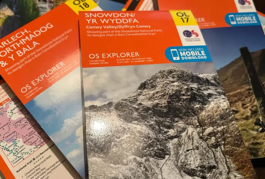
Ordnance Survey Explorer Maps
I’m not sure if you can beat the proper paper maps. I will be the first to admit that I rarely refer to the paper copies whilst I’m out on there trail but they are integral to planning my adventures. If I’m on a camping trip I always take the paper copy with me. I find the paper maps useful so I can study it without draining the battery of my phone on an app. I also like to buy one for each area I have visited so I can keep them as a sort of momento of my adventures.
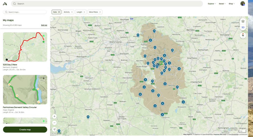
AllTrails
For drawing out hiking routes AllTrails is my go to solution. Unfortunately you can’t draw routes on the app but on the desktop website you can. It’s a pretty straight forward process too and all routes are able to snap to the paths so it gives you an almost exact representation of the distance and elevation that going to be involved in the hike.
When out on the trails I switch to the app and with the Pro subscription I’m able to download the maps so its doesn’t matter when I go into areas without any signal.
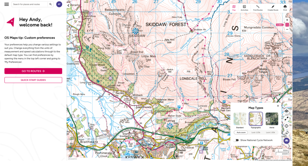
OSMaps
I’ll be honest I like OSMaps as it marks the triangulation pillars, unlike AllTrails. It brings the style of the traditional Ordnance Survey maps to the screen and I do enjoy that.
The route drawing software is not quite as good though. Outside of the National Parks the tools doesn’t always snap to paths. However, in popular areas you can draw out routes on the phone app which is pretty handy to be able to do that from the tent.
Apple Maps
I use Apple Maps for my sat nav whilst driving, so I thought I should mention it in here somewhere. I’ve found it pretty good you can download whole area maps so that even without a single you can set up a route. Which has been pretty handy on a few occasions but you do need to remember that it doesn’t include any live updates like traffics jams or road works until you have a signal.
Another nice touch is how Maps works with Podcasts and I assume Apple Music too. Where it replays the last second of the audio after a direction update from Siri. Just a nice little touch to make sure I don’t miss an important part of a fact on the No Such Thing as a Fish Podcast.
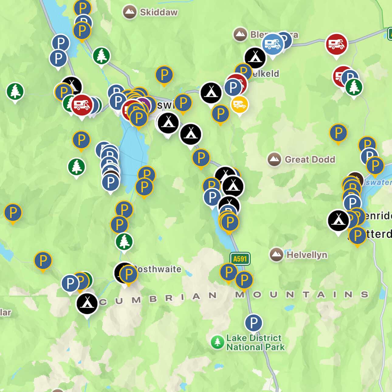
Park4Night
https://park4night.compark4night.com
This is great app for finding parking location across the UK. I’ve found it partiulary useful for finding spots to car camp. It is aimed towards people with camper vans but I find the information very useful.
Hiking in any wether – the tools I use to check in on the conditions
Its one of the things you can not predict, it makes it especially difficult to plan anything a long way away. These are some of the apps I use to be as prepared as I can for whatever weather conditions might be coming. Unfortunately it is rarely good news but luckily I am the opposite of a fair weather hiker.
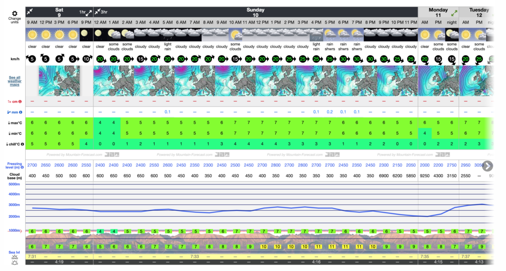
Mountain Forecast
I’ve found this to be the best location to learn about the weather conditions on the the tops of mountains. It is updated regular but this does sometimes means that when you check on a Thursday and Saturday morning looks like it’ll be sunny clear skies. That might be different on Friday, and different again on Saturday morning.
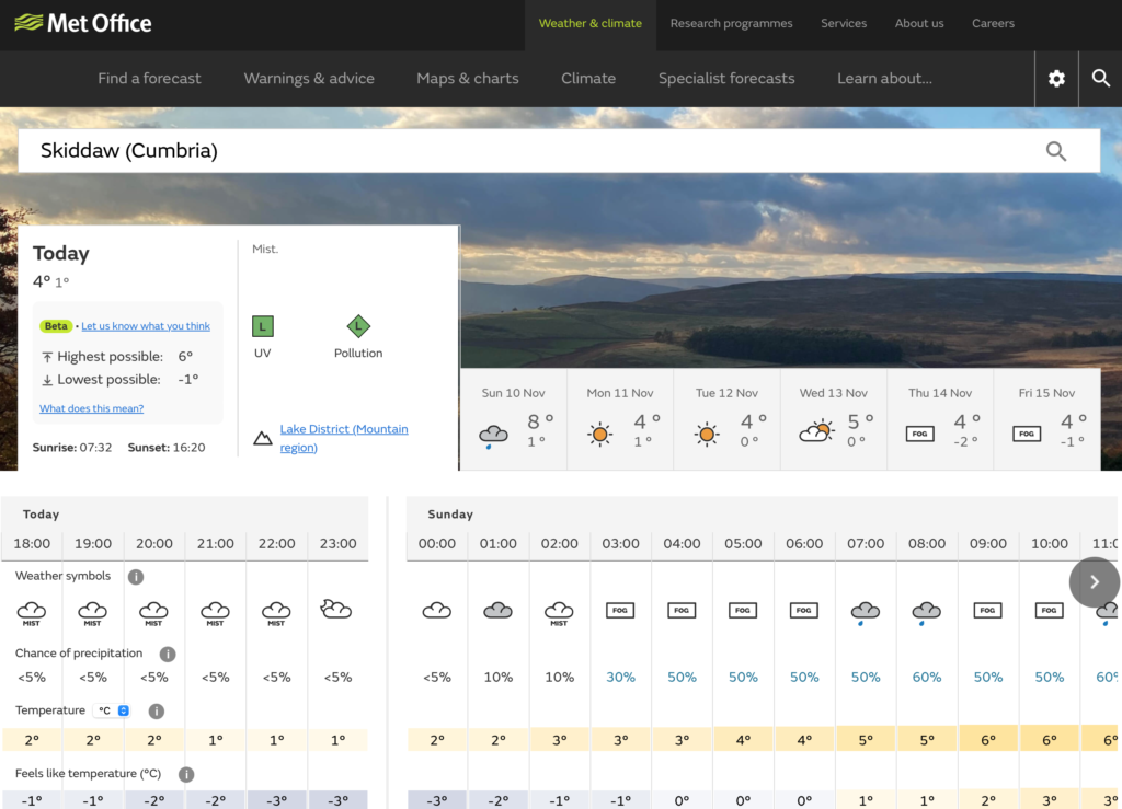
Met Office
It is one of the most reliable weather sources. The first to deliver any weather warnings and has conditions for the summits of many of the United Kingdoms highest mountains. It helps to stay prepared for shifts in the weather as you make your way up the mountains.
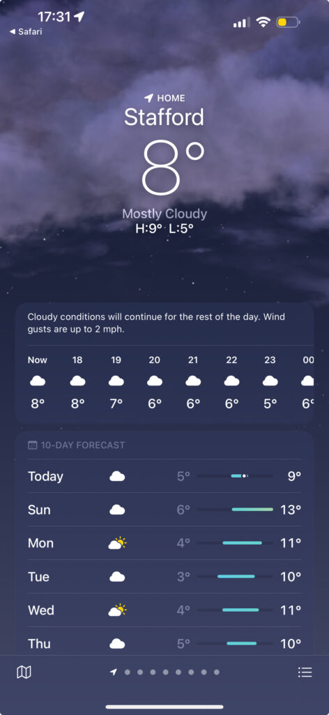
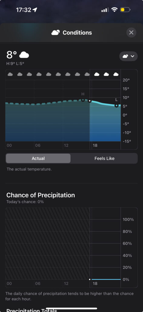
Apple Weather
I also do like the Apple weather app, mostly for it’s “next hour” weather predictions. I’ve found these to be extremely accurate. It gives you a warning of when rain will be starting and stopping and the intensity over the next hour. Which can help you to know when to make that dash from shelter to the car. The best time to start packing your tent away.
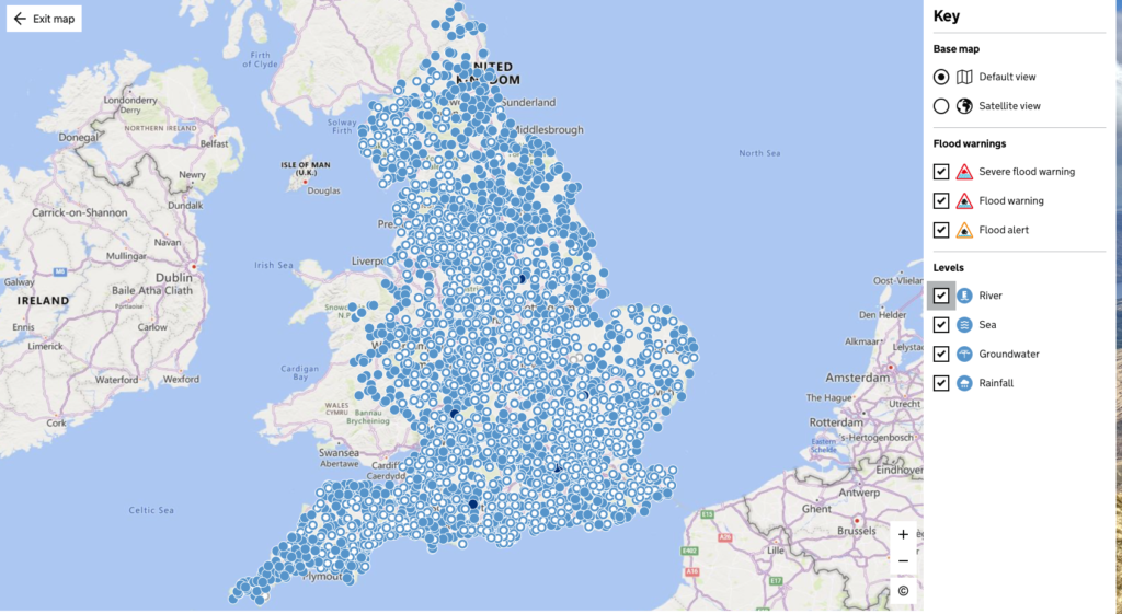
UK Flood maps
check-for-flooding.service.gov.uk
This is a very helpful tool. Rural locations can often have slightly underreported issues when I comes to flooding. Being able to check flood warnings and ground conditions across the country can help to ensure that I can bypass any flooded roads. With an added bonus that it can help with the selections of campsites and camping spots.
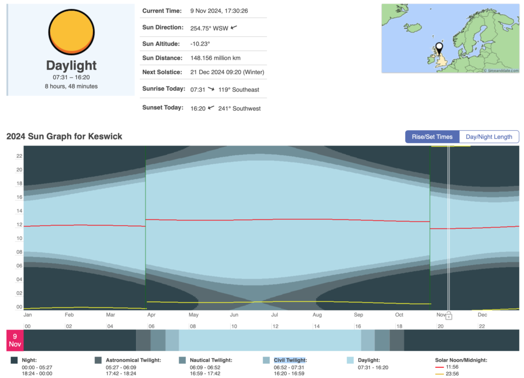
Time and date
I never thought that I could become obsessed with knowing when it’s night and day. I’ve found this site gives a very accurate sunrise and sunset times. It also does a great job of showing the other stages of night. Civil twilight coming right after the sunset is still pretty good for hiking, and knowing how nautical and astronomical follow on has also helped too. This is also the site that taught me that during the summer months we don’t actually enter true night time, well I find that interesting anyway.
Alternative routes and alternative days
Talking about the weather, I’ve found it always good to have alternative plans. As anyone who has spent anytime in Britain will be well aware that the sun is shy over our skies. Thanks to being stuck on the edge of a continent and an ocean we have slightly less predictable weather patterns than our counterparts on the continent.
This does meant that one longer trips like my Scotland tours, I like to make sure that I have alternatives and hikes to do even if the weather (or my legs) don’t allow for a mountain day.
Hopefully you’ve found it useful to know what I use to plan out my adventures. If you’ve got a tool you love to use which isn’t on the list, let me know so I can check it out.
If you want to learn about some of the kit I take with me on my adventures you can check out these posts on my Stafford 2 Snowdon equipment and my day hike pack.